Commons:Featured pictures/Non-photographic media/Maps
Jump to navigation
Jump to search


|
||||||||||||||||||||||||||||||||||||||||||||||||||||||||||||||||||

|
|
Galleries containing featured pictures of static non-photographic media:


.jpg/180px-Islamic_geometric_patterns_(Aydar_kadi_mosque%2C_Bitola%2C_Macedonia).jpg)
Maps[edit]
Maps of Africa[edit]
-
 Fernão Vaz Dourado 1571
 -
 Map of Gabon (in French)
 -
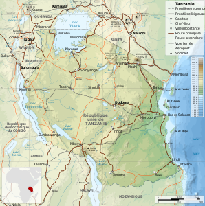 Map of Tanzania (in French)
 -
 Geographic map of Somaliland
 -
_-_Geographicus_-_Africa2-boulton-1794.jpg/358px-1794_Boulton_and_Anville_Wall_Map_of_Africa_(most_important_18th_cntry_map_of_Africa)_-_Geographicus_-_Africa2-boulton-1794.jpg) 1794 Boulton and Anville Wall Map of Africa (most important 18th cntry map of Africa) - Geographicus - Africa2-boulton-1794
1794 Boulton and Anville Wall Map of Africa (most important 18th cntry map of Africa) - Geographicus - Africa2-boulton-1794


_-_Geographicus_-_Africa2-boulton-1794.jpg)
|
Maps of the Americas[edit]
-
 Early map of the Americas 1640

|
Maps of North America[edit]
-
 Denali National Park (1994)
 -
 North Cascades National Park (1987)
 -
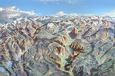
 Yellowstone National Park (1991)
 -
 Yosemite National Park (1989)
 -
 New York state geographic map-en
 -
 Public Roads of the contiguous United States, from the 2018 TIGER GIS dataset
 -
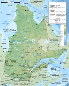 Quebec province topographic map
 -
 Early map of North America 1681
 -
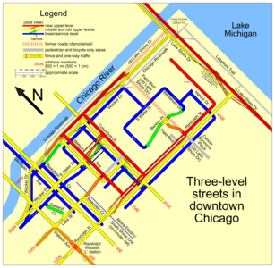 The multilevel streets in downtown Chicago
 -
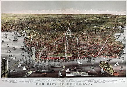 Brooklyn, New York, 1879
 -
 Florida topographic map
 -
 California island by Vinckeboons
 -
 Delaware Bay Vinckeboons
 -
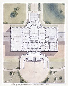 Plan of the White House
 -
 Hispaniola by Vinckeboons
 -
 NYC subway-4D
 -
 Philadelphia Street Map, 1802
 -
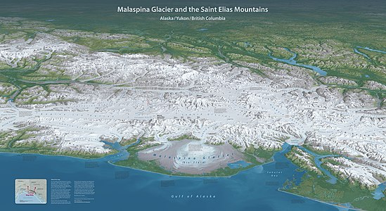 Malaspina-panorama-meters


|
Maps of South America[edit]
-
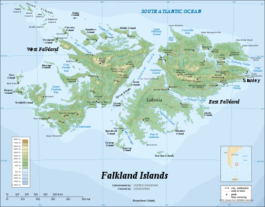 Falkland Islands topographic map
 -
 Easter Island topographic map
 -
 Nueva Esparta Street map, Venezuela 2007
 -
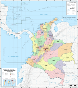 Map of Colombia 2009
 -
 1635 Blaeu Map Guiana, Venezuela, and El Dorado - Geographicus - Guiana-blaeu-1635
 -
 The seat of war in the West Indies 1740


|
Maps of Antarctica[edit]
-
 Kerguelen topographic map in French
 -
 Antarctica 1912


|
Maps of Asia[edit]
-
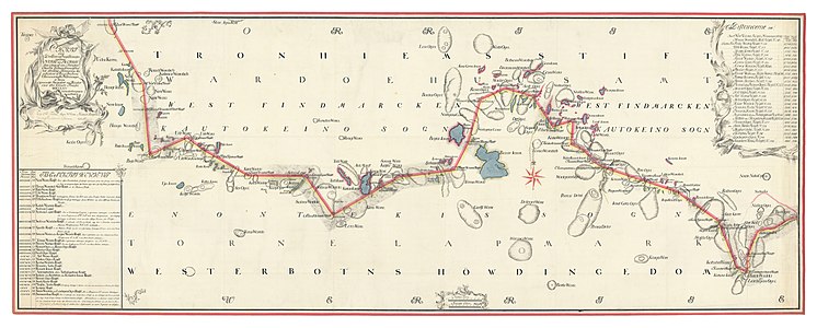
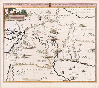 The Situation of the Terrestrial Paradise, 1700
 -
 Effort to reassure the faithful by locating the site of Paradise, 1665
 -
_1803.jpg/397px-Cedid_Atlas_(Middle_East)_1803.jpg) Cedid Atlas (Middle East) 1803
Cedid Atlas (Middle East) 1803 -
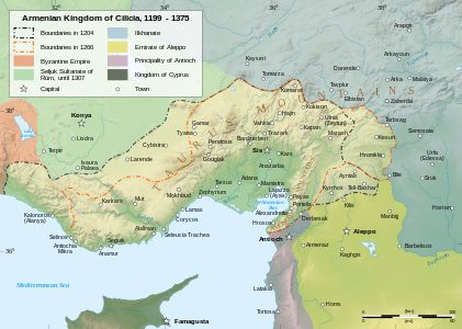 Cilician Armenia
 -
 India roadway map
 -
 Desert Storm campaign
 -
 Old Korea map 1861
 -
 Kisaburō Ohara, Europe and Asia Octopus Map, 1904 Cornell CUL PJM 1145 01
 -
 Map of Hindoostan, 1788, by Rennell
 -
 Map of Abkhazia
 -
 Everest-3D-Map-Type-EN
 -
 1922 Index of Great Trigonometrical Survey of India


_1803.jpg)


|
Maps of Europe[edit]
-
 Corsica-geographic map-fr
 -
 1580 Lucas Janszoon Waghenaer Carte de l'ouest de la bretagne
 -
.jpg/401px-Map_of_Europe%2C_1946_(25289557032).jpg) Map of Europe, 1946 (25289557032)
Map of Europe, 1946 (25289557032) -
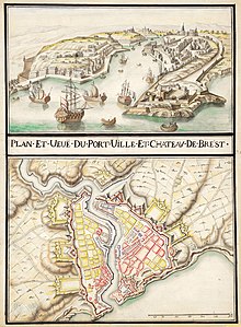 Port, ville et château de Brest ca 1700
 -
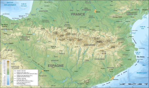 Pyrenees topographic map
 -
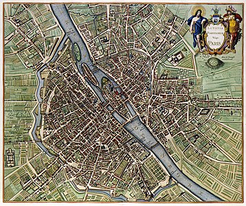
 Map of Paris 1576
 -
 Caspar Merian, Paris wie solche Ao. 1620 im wessen gestanden, 1655 - David Rumsey
 -
 Derveaux & Tavernier, Le plan de la ville, cité, université fauxbourg de Paris - Paris Musées
 -
 Map of Paris 1657
 -
 Map of Paris by Claes Jansz. Visscher
 -
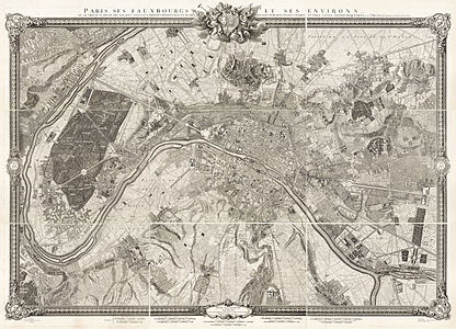 Roussel, Paris, ses fauxbourgs et ses environs, 1731
 -
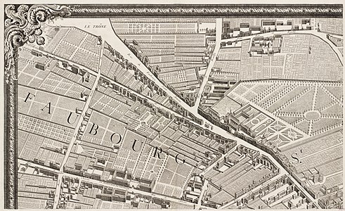
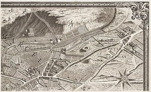
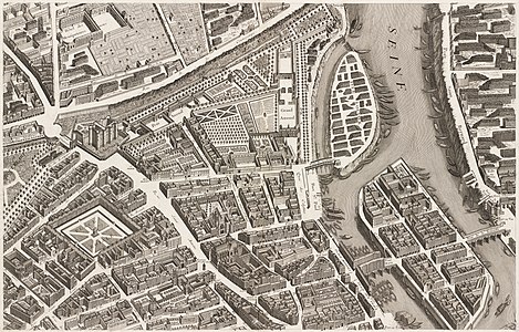
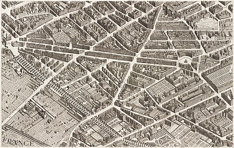
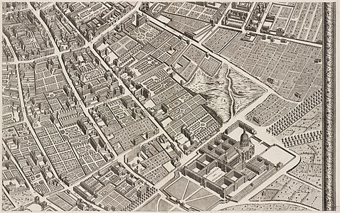
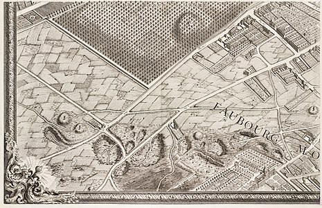
 Turgot map of Paris 1739, Norman B. Leventhal Map Center
 -
 Turgot map of Paris 1739, Norman B. Leventhal Map Center
 -
 Turgot map of Paris 1739, Norman B. Leventhal Map Center
 -
 Turgot map of Paris 1739, Norman B. Leventhal Map Center
 -
 Turgot map of Paris 1739, Norman B. Leventhal Map Center
 -
 Turgot map of Paris 1739, Norman B. Leventhal Map Center
 -
 Turgot map of Paris 1739, Norman B. Leventhal Map Center
 -
 Turgot map of Paris 1739, Norman B. Leventhal Map Center
 -
 Turgot map of Paris 1739, Norman B. Leventhal Map Center
 -
 Turgot map of Paris 1739, Norman B. Leventhal Map Center
 -
 Turgot map of Paris 1739, Norman B. Leventhal Map Center
 -
 Turgot map of Paris 1739, Norman B. Leventhal Map Center
 -
 Turgot map of Paris 1739, Norman B. Leventhal Map Center
 -
 Turgot map of Paris 1739, Norman B. Leventhal Map Center
 -
 Turgot map of Paris 1739, Norman B. Leventhal Map Center
 -
 Turgot map of Paris 1739, Norman B. Leventhal Map Center
 -
 Turgot map of Paris 1739, Norman B. Leventhal Map Center
 -
 Turgot map of Paris 1739, Norman B. Leventhal Map Center
 -
 Turgot map of Paris 1739, Norman B. Leventhal Map Center
 -
 Turgot map of Paris 1739, Norman B. Leventhal Map Center
 -
 Turgot map of Paris 1739, Norman B. Leventhal Map Center
 -
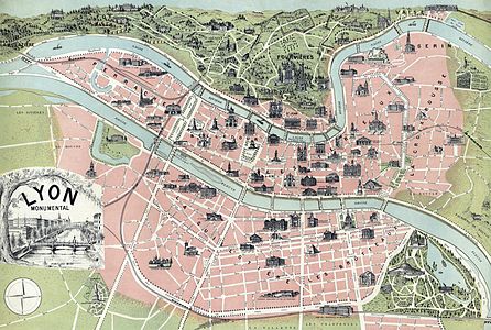 Lyon monumental, 1894
 -
 Old map of Alsace-Lorraine, between France and Germany, 1887
 -
 F. Müllhaupt's Military and commercial Franco-German border map
 -
 Lake Millstatt, Austria
 -
 Wall map of Southwestern Germany 1875
 -
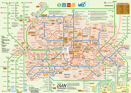 Munich's public transport network 2006
 -
 Old map of western Germany, from 1791
 -
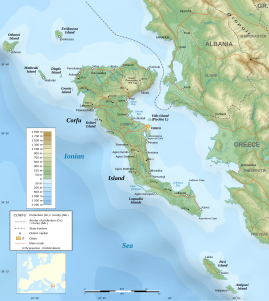 Corfu Island topographic map
 -
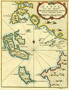 Bellin map of the Ionian Islands, 1797
 -
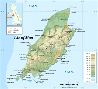 Isle of Man topographic map
 -
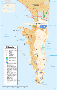 Map of Gibraltar
 -
 topographic Map of Scotland
 -
 Map of Scotland
 -
 Map of the county of Flanders
 -
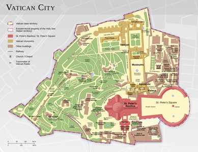 Map of the Vatican City – English
 -
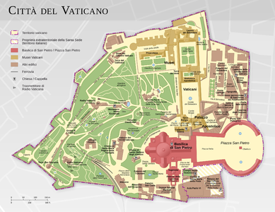 Map of the Vatican City – Italian
 -
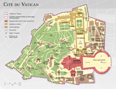 Map of the Vatican City – French
 -
 Map of the Vatican City – German
 -
 Map of Kosovo
 -
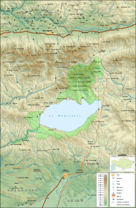 Map of Markakol Nature Reserve, Kazakhastan
 -
 1580 Map of Zeeland
 -
 Portuguese nautical chart by Pedro Reinel (c. 1504)
 -
 Map of Switzerland, 1913
 -
 1730 Homann Map of Scandinavia
 -
 Old map of Scandinavia
 -
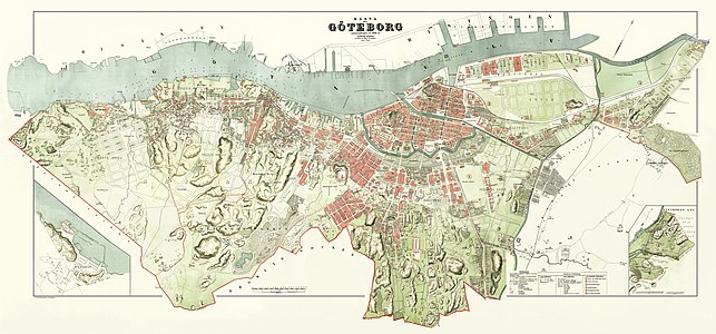 Simon's 1888 Gothenburg map
 -
 1923 map of Europe
 -
 Aguiar's chart of the Mediterranean, Western Europe and African Coast, 1492
 -
 Plan La Rochelle et environs, 1773, Nicolas Chalmandrier, BNF Gallica
 -
 Plan du jardin et chateau de la Reine
 -
 Esquisse d'une carte géologique d'Italie
 -
 Pictorial Representation of the Illustrious City of Venice Dedicated to the Reign of the Most Serene Dominion of Venice
 -
 Insula Maioricae Vicentius Mut 1683
 -
 Lancashire 1610 Speed Hondius - Restoration
 -
 CzechRepublic-geographic map-en
 -
 Carte du cours du Rhône de Genève à Lyon - 1787.jpg
 -
 Carte de Brest - ca 1700 - Bibliothèque Nationale de France - Btv1b8439976x
 -
 Antoine Aveline ca 1700 vue cavalière de la ville de Brest
 -
 Btv1b530849639 plan du port et de la ville de Brest 1855 restored
 -
 Ethnographic map of austrian monarchy czoernig 1855
 -
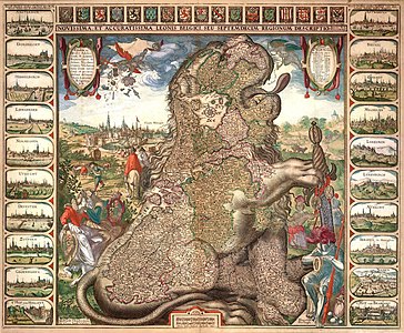 Sitting Leo Belgicus - Visscher
 -
 Angling in Troubled Waters A Serio-Comic Map of Europe
 -
 Grensekart nr. 21
 -
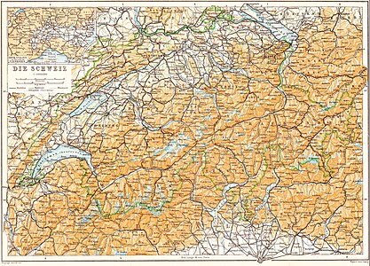
 General Map of Switzerland
 -
 Physical map of Ancient Greece-ru


.jpg)


|
Maps of Oceania[edit]
-
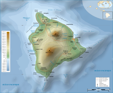 Topographic map of Hawaii

|
Maps of the world[edit]
-
 Atlas Catalan Abraham Cresques
 -
 Waldseemüller map from 1507
 -
 Global cyclone tracks map
 -
 van Schagen world map, 1689
 -
 Bartolomeu Velho, 1568
 -
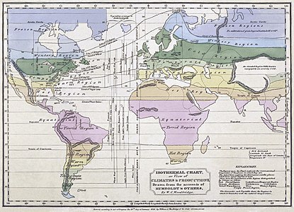 Woodbridge isothermal chart, 1823
 -
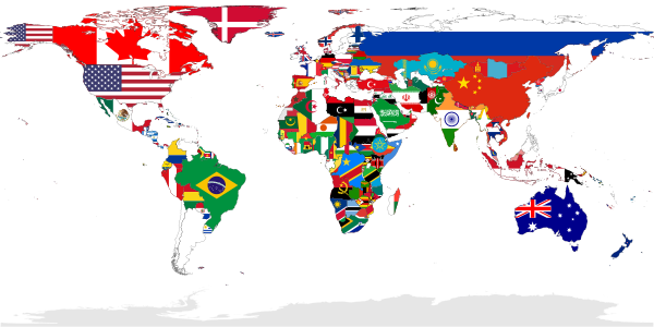 Flag-map of the world
 -
.jpg/669px-Kunyu_Wanguo_Quantu_(坤輿萬國全圖).jpg) Copy of the 1602 map Kunyu Wanguo Quantu, by Matteo Ricci
Copy of the 1602 map Kunyu Wanguo Quantu, by Matteo Ricci -
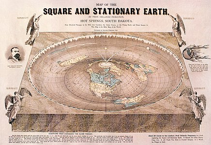 Orlando-Ferguson-flat-earth-map edit
 -
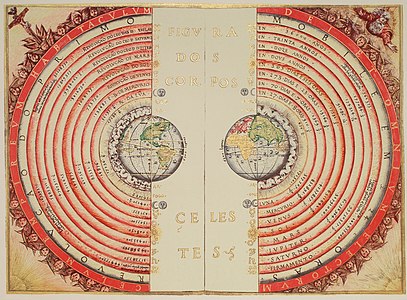
 From Harmonia Macrocosmica (1660-61) by Cellarius: Ptolemaic system
 -
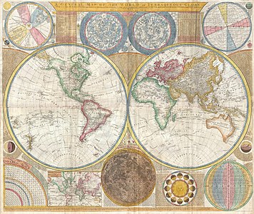 1794 Samuel Dunn Wall Map of the World in Hemispheres
 -
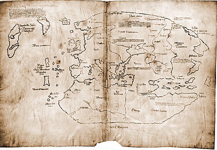 15th century Vinland Mappa Mundi, redrawn from a 13th century original
 -
.jpg/639px-Cantino_planisphere_(1502).jpg) Cantino planisphere (1502)
Cantino planisphere (1502) -
 Moxon A Map of the Earth 1681 Cornell CUL PJM 1012 01
 -
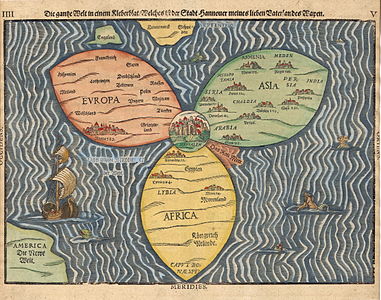 Stylized world map in the shape of a clover-leaf


.jpg)


.jpg)


|
Other maps[edit]
-
 Map of the Countries Between England & India (1855)
 -
 Ethel Franklin Betts, Save the Survivors, 1918 Cornell CUL PJM 2029 01
 -
 How The Public Domain Has Been Squandered 1884 Cornell CUL PJM 1088
 -
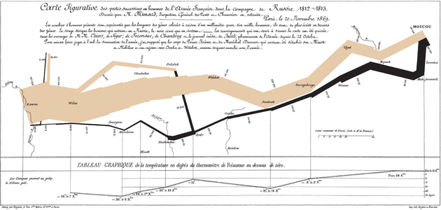 Charles Minard’s 1869 chart
 -
 Henry Mayer, The Awakening, 1915 Cornell CUL PJM 1176 01
 -
 Victor Gillam A Thing Well Begun Is Half Done 1899 Cornell CUL PJM 1136 01
 -
 An Illustrative Map of Human Life Deduced from passages in Sacred Writ, 1847
 -
 This is a folk-art allegorical map based on Matthew 7:13-14 Bible Gateway by the woodcutter Georgin François in 1825
 -
 The Journey of Life, or an Accurate Map of the Roads, Counties, Towns &c. in the Ways to Happiness & Misery. 1775
 -
 The Road From the City of Destruction to the Celestial City
 -
 Michelangelo Caetani: The Divine Comedy Described in Six Plates (1855): FrontPage
 -
 Michelangelo Caetani: Overview of the Divine Comedy (1855): Overview of the Divine Comedy
 -
 Michelangelo Caetani: The Divine Comedy Described in Six Plates (1855): The Ordering of Hell
 -
 Michelangelo Caetani: The Divine Comedy Described in Six Plates (1855): Map of Hell
 -
 Michelangelo Caetani: The Divine Comedy Described in Six Plates (1855): Cross Section of Hell
 -
 Michelangelo Caetani: The Divine Comedy Described in Six Plates (1855): The Ordering of Purgatory
 -
 Michelangelo Caetani: The Divine Comedy Described in Six Plates (1855): The Ordering of Paradise
 -
 The geologic map of the Moon at 1-2.5M scale


|
Unsorted[edit]
The FPCBot will place images here, they can manually be sorted into more specific sections. When moving away images do not remove the gallery itself and let this section be the last on the page.
| Nature |
| |||||||||||||||||
|---|---|---|---|---|---|---|---|---|---|---|---|---|---|---|---|---|---|---|
| Food and drink | ||||||||||||||||||
| Historical | ||||||||||||||||||
| Objects |
| |||||||||||||||||
| People | ||||||||||||||||||
| Places |
| |||||||||||||||||
| Space | ||||||||||||||||||
| Photo techniques | ||||||||||||||||||
| Static non- photographic media | ||||||||||||||||||
| Animated | ||||||||||||||||||